"Normal" vector layers store geometrys using numerical coordinates (depending on the geometry type, single points or sequences of points with X/Y coordinates).
"Linearly referenced" layers use numerical stations (points or segments) on associated line geometrys.
A subsequent change to the LR mode is possible, but requires the conversion of existing stationings.
This can be done with field-calculater, alternatively with python-script:
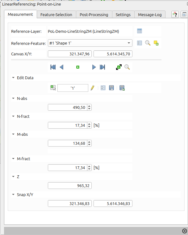
| LineString | vs. | LineStringZM (with registered Data-layer) |
 |
 |
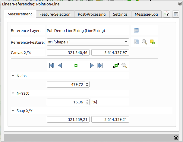
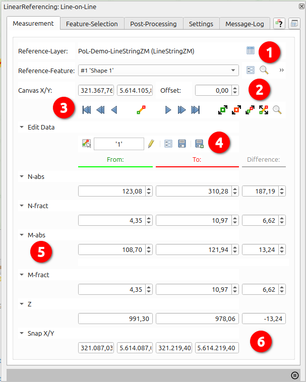
For measurement only the registration of a suitable reference layer (LineString) is required.
 |
|
 |
|
 |
|
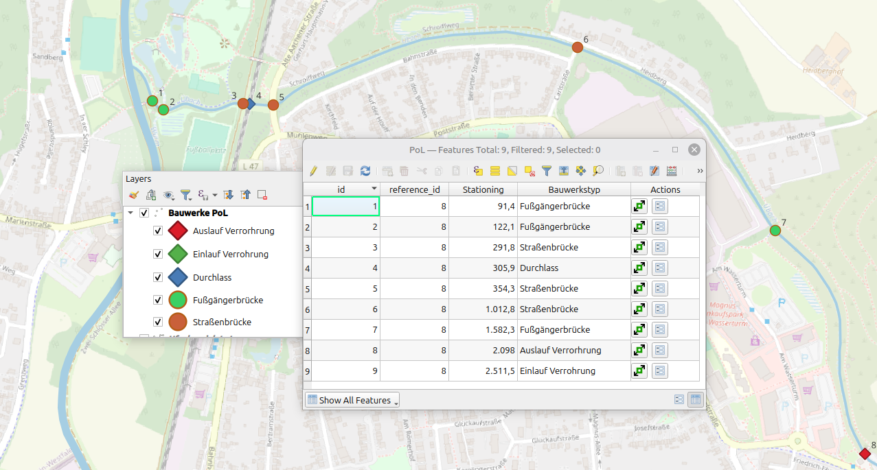
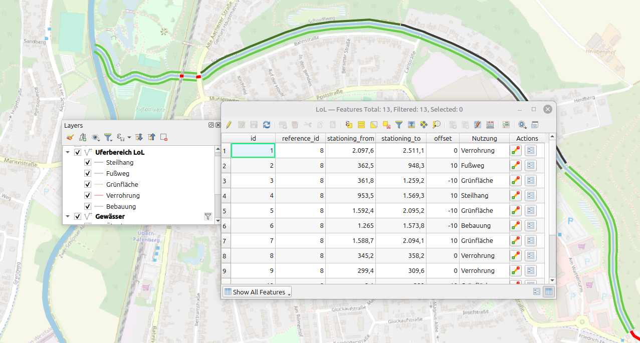
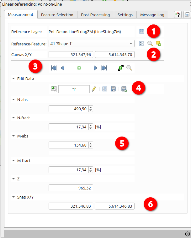
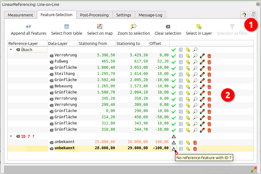
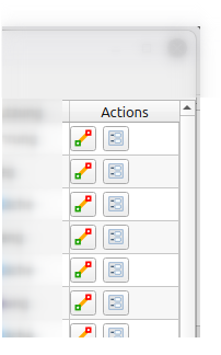
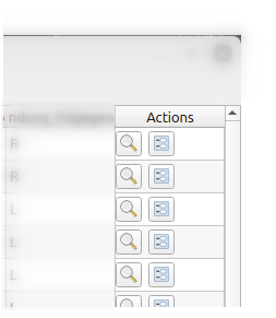
User-definable selection of records for visualization and editing.
Selection can be done on map
, from
attribute-tables/forms (Data-layer/Show-layer) (see Layer-Actions) or using ![]() .
.
Plugin-recorded features are also included.
Validation-problems (f. E. stationings out of bounds, missing reference-features...) are symbolized in treeview with according hints.
|
|
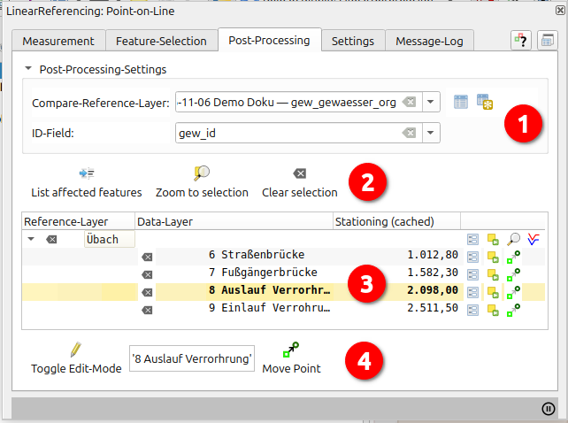
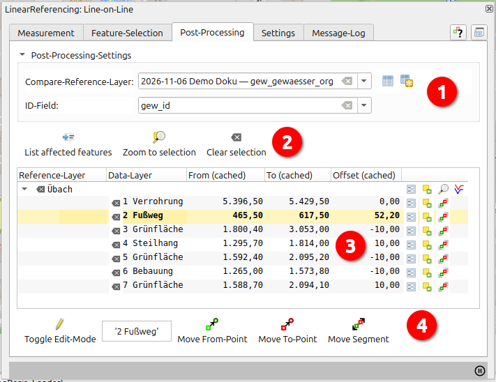
"PostProcessing" allows the combination of Data-Layer with an alternative reference-layer-version (must have same geometry-type, projection, reference-ids as reference-layer). As result all records are with affected linear referenced geometries are listed.
From this list the two versions can be cartographically contrasted und stationings adjusted.
 |
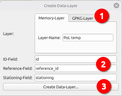
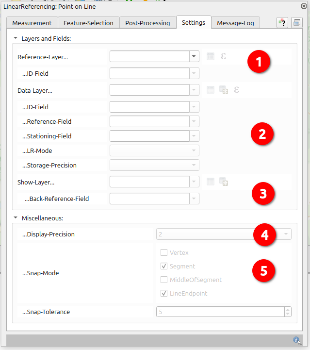
1. Settings:
|
 |
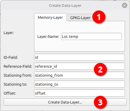
1. Settings:
|
Base for all usages is the "Reference-Layer", for recording a "Data-Layer" is necessary, for cartographic representation a "Show-Layer".
|
|
|
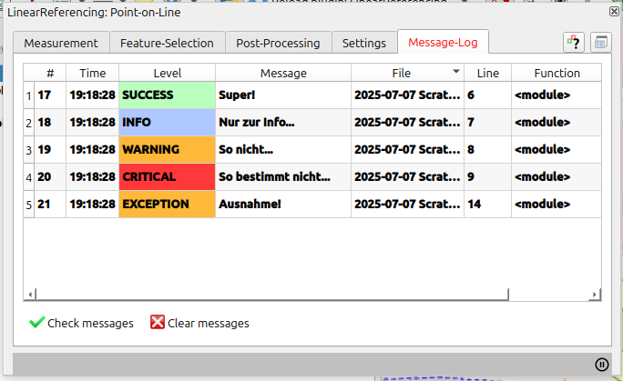
System-messages, errors, debug-metas (file/line/function/backtrace as tooltip)
| PoL Data + Show-Layer: | LoL Data + Show-Layer: | LoL/PoL Reference-Layer: | |
|---|---|---|---|
|
|
|
|
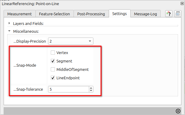
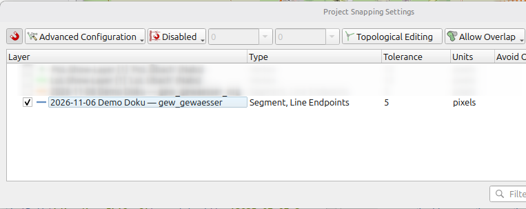
The configurable snap-settings under Settings/Miscellaneous are a subset of QGis-Advanced-Snap-Settings and applied to reference-layer.
With each use of one of the plugin-maptools these settings will replace any other snap-settings in the current project.
| Plugin | => | Projekt |
|---|---|---|
 |
 |
Author:
Ludwig Kniprath
Mailto:
ludwig[at]kni-online.de
Plugin-Version:
2.1.0 (2026-01)
Plugin-Download:
Source-Code und Tracker:
https://github.com/Ludwig-K/QGisLinearReference/
Lizenz:
GNU General Public License v3.0